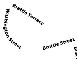
0 LOT BRATTLE TERR
Owner Information
MORRISSETTE LAURA--ETAL
17 WASHINGTON STREET
ARLINGTON, MA 02474


Property Details
0 LOT BRATTLE TERR is classified as a Undevelopable Residential Land.
0 LOT BRATTLE TERR is valued at $51,300. The land is valued at $51,300 and the structures are valued at $0.
This property is in Zone R2. Confirm with local Zoning Board authorities to ensure there are no overlays or other easements on this property.
The most recent deed for 0 LOT BRATTLE TERR is recorded at the local registrar in Book 15845, Page 321. 0 LOT BRATTLE TERR was last sold on Monday, October 1, 1984 for $140,000.
Assessment data from fiscal year 2022.
Flood Data
According to the FEMA National Flood Hazard Layer, this property does not appear to be in a flood zone. It may also be in an area not yet reviewed. Nonetheless, confirm this information prior to taking any action.
To view the flood hazards around this property, create a FEMA "Firmette" Map of the area around 0 LOT BRATTLE TERR.
Broadband Internet Providers
| Provider | Type | Bandwidth (mbps) | |
|---|---|---|---|
| HughesNet | Satellite | 25 | 3 |
| VSAT Systems, LLC. | Satellite | 2 | 1 |
| GCI Communication Corp. | Satellite | 0 | 0 |
| T-Mobile | Fixed Wireless | 25 | 3 |
| Starry, Inc. | Fixed Wireless | 200 | 200 |
| RCN | Cable | 1000 | 20 |
| RCN | Cable | 500 | 20 |
| Comcast | Cable | 1000 | 35 |
| Verizon New England Inc. | Fiber | 940 | 880 |
| Verizon New England Inc. | DSL | 5 | 0 |
| Viasat Inc | Satellite | 100 | 3 |
Broadband service provider data from December 2020.